Wednesday, December 24, 2008

Amazing aerial photos

Aerial photography can produce unique shots that look different than any other ground shot you have ever taken...

http://www.smashingmagazine.com/2008/12/21/75-eye-catching-examples-of-aerial-photography/

Thursday, December 11, 2008

Helicopter aerial photography video.

A video tutorial that takes you on board a helicopter with a professional photographer on assignment;
includes information on composition, distance, horizons, pilot orders.

Have a look on youtube.com Total video time 7 minutes.

http://www.youtube.com/watch?v=mjSnrl8KzbA

Tuesday, October 28, 2008

Aerial Photographer joke


A photographer for a national magazine was assigned to take pictures of a great forest fire.
He was advised that a small plane would be waiting to fly him over the fire.

The photographer arrived at the airstrip, just an hour before sundown.

A small two-seat airplane was waiting.

He jumped in with his equipment and shouted, “Let’s go!”

The tense man sitting in the pilot’s seat swung the plane into the wind and soon they were in the air, though flying erratically.

“Fly over the north side of the fire,” said the photographer, “and make several low-level passes.”

“Why?” asked the nervous pilot.

“Because I’m going to take pictures!” yelled the photographer.

“I’m a photographer, and photographers take pictures.”

The pilot replied, “You mean you’re not the flight instructor?”
Sunday, October 19, 2008

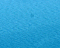
Removing dark spots from the sky or the sea.

One of the techniques you can use is "The History Brush Technique".

The Photoshop History Brush Tool technique allows you to clean up large areas of dirt quickly when the area to be cleaned contains very little detail e.g. the sky or other background area.

Go to Filter / Noise / Dust & Scratches... and choose a radius large enough to remove all the blemishes. The whole image will be blurred, but it's ok.

Select the History Brush and in the History Palette, click on the small square box on the left of the Dust & Scratches history. This sets the origin for the History Brush.

Now click in the previous History state, the larger rectangular box immediately above and to the right. This returns us to the unblurred image.

With the Mode set to "Lighten" paint over the dirt with the History Brush.

All traces of dirt will vanish.

Saturday, October 4, 2008

Aerial Photography tips for beginners

Here are the basics of aerial photography.

Prices are in US$, everything else applies worldwide.


Aerial Photography tips

Friday, October 3, 2008

Do it Yourself Remote Shutter.

Here is something that could be useful in Pole Aerial Photography.

How to make a remote shutter release for your canon digital camera using a hands free.


http://www.instructables.com/id/Remote-shutter-trigger-for-Canon-Cameras

.

Thursday, September 25, 2008

Early specialist in Aerial Photography dies at 91


Don Ultang, an early specialist in aerial photography died on Sept. 18 in Iowa, where he lived. He was 91.

In 1952, Ultang and fellow photographer John Robinson were awarded the Pulitzer Prize for a series of images showing a violent on-field assault against an African-American player during an American college football game. The event came to be known as the Johnny Bright Incident.


Donald Theodore Ultang graduated from the University of Iowa in 1939 with a degree in economics.
As he was interested in photography, he was hired by an Iowa newspaper and shortly thereafter decided to learn to fly, signing up for a government-financed civilian pilot program.

Ultang joined the Navy during World War II and served as a flight instructor.

On his return, he persuaded the Iowa newspaper to buy a Beechcraft Bonanza
plane for editorial use, like aerial photography.

He flew the airplane and took pictures while flying. He let go of the controls for about 5 seconds to shoot with a heavy Speed Graphix camera, before circling around for another take, often just a few hundred feet above the ground, keeping about 20 miles per hour extra air speed.

Many of his pictures were collected in "Holding the Moment: Mid-America at Mid-Century" (Iowa State Press, 1991).


Tuesday, August 26, 2008

The perfect aerial photography vehicle...


...is the "powered parachute" according to photographer Maxwell Mackenzie.

Read his story here: The flying photographer by Marianne Combs, Minnesota Public Radio.

http://minnesota.publicradio.org/display/web/2008/08/15/flyingphotographer/

Saturday, August 2, 2008

Photography business may fly to Saudi Arabia


Canadian remote-controlled miniature helicopters may be used in an aerial photography contract in Saudi Arabia.

Read the story here: LOCAL FIRM APPLIES FOR CONTRACT IN SAUDI ARABIA

Saturday, June 28, 2008

Aerial photographers killed in ANTONOV AN-2 crash near Moscow


A small plane conducting an aerial photography assignment crashed Friday near Moscow, killing all five people on board.

The Antonov An-2 crashed by the banks of the Oka River, about 100 kilometers (60 miles) from Moscow.

The single-engine biplane's crew of two and all three members of the aerial photography team died.

It seems that the plane fell from an altitude of between 1.5 and two kilometers (over a mile) and burst into flames when it hit the ground. Contact with the aircraft was lost 10 minutes after take-off.

Police started receiving calls about a falling plane at around 6:00 pm local time (14:00 GMT). Russian prosecutors have launched a full inquiry.


(In early June another An-2 plane engaged in crop spraying and operating under reduced visibility conditions, crashed in southern Russia's Stavropol region, killing the two pilots.)


Read the original news

AN-2 plane in Wikipedia


Sunday, May 25, 2008

Klaus Leidorf. Aerial Photographer in Germany, EU


Klaus Leidorf is a German aerial archaeologist flying a CESSNA 172 in Germany.

Read about him at popphoto.com:

He's got a strong eye for geometry and landscapes, which you can admire in his collection of aerial photos http://www.flickr.com/photos/leidorf

His personal website (in german) is www.leidorf.de


Monday, April 21, 2008

Friday, April 4, 2008

Do it yourself orthophotography


Do it yourself orthophotography in an Alaskan village mapping project.

What you need is a helicopter, a digital camera and photo-modeling software.


Very interesting!

Download the article here (Adobe acrobat pdf file)

Thursday, March 20, 2008

Benefactor & aerial photographer Mary Meader dies at age 91


Mary Upjohn Meader, a longtime Western Michigan University benefactor and director emerita of the WMU Foundation, died March 16 in Kalamazoo. She was 91.

As a young woman in 1937, Meader flew over both South America and Africa took a treasure trove of aerial photos that are still being used by scholars today.

Representatives of the American Geographical Society asked Meader to sign the historic Flyers' and Explorers' Globe twice to mark those momentous flights.

You can view some of the photos she's taken here and here.

To read about her click here.


Saturday, March 8, 2008

Aerial photography as a tool for the archaeological research


The remains of the Via Egnatia between Amphipolis and Philippoi in Greece were found using aerial photos of the region.

Four researchers of the Department of Cadastre, Photogrammetry and Cartography, Aristotles University of Thessaloniki, Greece, found buried archaeological remains with the aid of the Pan-sharpened (fused) image Quickbird-2.

The full paper with photos is located here: http://www.isprs.org/istanbul2004/comm7/papers/202.pdf

Thursday, February 21, 2008

David Maisel exhibition. Santa Barbara Museum of Art

until April 27, 2008

These large scale images by San Francisco-based photographer David Maisel are printed as negatives rather than positives, providing views of the city. These photographs provide x-rays of a city’s anatomy making them all the more frightening as claustrophobic expanses.

More details here. The museum's homepage is here.

Monday, February 18, 2008

How to choose an aerial photographer...

...or an aerial photography company

Read about all the details that make the difference
here.

Wednesday, February 13, 2008

World War II aerial reconnaissance archive.

Looking for Second World War aerial reconnaissance photos? Here they are.

The internationally important archive of WW2 Allied and German aerial photographic imagery is moving to Edinburgh (Royal Commission on the Ancient and Historical Monuments of Scotland).


Saturday, February 9, 2008

Model Airplane Found Missing Man

In October 2005, a model airplane fitted with a digital camera found a man missing in West Texas, US, four months after he went missing.
During that time search parties on foot and horseback had scoured the desert in an expensive search. In just three sorties within one day the model airplane took 200 images and the search team rapidly found the body of David Lee Pettiet.

Read the whole story here.

Wednesday, February 6, 2008

History of aerial photogrpahy

The first aerial photograph from a balloon was taken in France by Felix Nadar (his real name was Gaspard-Félix Tournachon). It was an image taken in Petit-Clamart, south-west of Paris, in December 1858, from a balloon tethered at a height of 270 feet. That first image has unfortunately been lost.

One of the earliest aerial photos of Paris, France can be found here. ©Hervé Lewandowski/RMN.

The story behind the First U.S. Aerial Photograph, in Boston, (1860) can be found here. View the photo here.

The first kite aerial photograph was taken by Arthur Batut in Labruguière (France) in 1888. Arthur Batut Museum (in French).

In 1906 George Raymond Lawrence just after the earthquake in San Francisco, CA used a system of kites and wires that carried a 46-pound panoramic camera 800 feet into the air and took some aerial pictures of the ruins.

Tuesday, February 5, 2008

Q: How can I have Real Time aerial photos?

A: Some people try to find a "Google Earth live".

I even was once asked for such a thing by a journalist, who was looking for satellite live camera feed, in order to cover a story developing in a dangerous area(!!!)

Sorry folks! It doesn't exist, at least not for you and me.

Unless you have your own satellite, you can't have Real Time Aerial Photos.

That simple.


PS Weather satellite images are as close to "real time" as you can get, but you can only see the clouds there.


Here are some samples:

ftp://ftp.dfd.dlr.de/put/wetterbilder/Greece/image1.jpg

http://www.ssec.wisc.edu/data/geo/east/

Sunday, February 3, 2008

Pilots needed for aerial photography

Read here the details of the job.

Here's another one for
twin engine Cessna, Piper and Beechcraft aircrafts.

Search for more airline, airport and business aviation opportunities in jetemployment.com or findapilot.com


Wednesday, January 30, 2008

BAP at Photopreneur.com

Photopreneur is a "must read" for anyone trying to monetize on photos.

And (talking about aerial photography), here's their latest Can a Balloon Inflate your Photography Income? post.

Saturday, January 26, 2008

County in North Carolina, US buys camera.

Harnett County in North Carolina, US will get US$11,664 for camera equipment that will be used for aerial photography.

Read the whole story here

Wednesday, January 23, 2008

Radio Controlled Helicopters For Aerial Photography

An interesting article on using RC Helicopters For Aerial Photography on rchelisite.com including advantages and disadvantages. click here.

Monday, January 21, 2008

CFP: International aerial archaeology conference

Here's an interesting call for papers.

CALL FOR PAPERS

International aerial archaeology conference (AARG 2008)
Ljubljana, 9 - 11 September 2008

Hosted by the Department of Archaeology, Faculty of Arts, University of Ljubljana
Proposals for sessions, papers and posters are invited.

Read the details here.

Sunday, January 20, 2008

Ground Based Aerial Photography

Areal photographs can be obtained in many different ways.

An airplane (e.g. the Cessna 172) can be used for heights between 500 feet (above sea) and 10.000 feet.

A Helicopter, ( HAP) especially for heights below 500 feet.

A remotely controlled helicopter ( RCAP) for heights up to 300 feet.

A blimp (or balloon, or zeppelin) ( BAP) for heights up to 500 feet.

A kite ( KAP ) (not recommended for professional use).

And finally, a rising trend, a Mast ( GBAP ) for heights up to 100 feet.

For details try to google search the expressions: "Ground Based Aerial Photography" or Mast aerial photography (the latter without quotes).

Saturday, January 19, 2008

Improper development spied from sky

Comparing old and new aerial photographs, state environmental officials spotted a suspicious-looking change in the landscape in Methuen, Massachusetts.

In July, they visited a horse stable on Tyler Street and confirmed that the owner had graded and filled wetlands without a permit, in violation of state environmental laws and regulations.

Read the whole story here


Blimp in Brazil

A youtube video of a Brazilian company, using a blimp for aerial photography shots.

http://www.youtube.com/watch?v=v5ESNkPFSpw

A saddle that absorbs vibration.

Here's an interesting product from an Australian company.

It's the Cinesaddle, a "dynamic mount" for a video camera that moves.
High tech beans inside the Cinesaddle absorb vibration, providing a very stable surface for the camera.

For still picture cameras have a look at their
Babysaddle.

http://cinekinetic.com

Wednesday, January 16, 2008

Policemen in Nebraska, US use aerial photos

Aerial photos are a tool for police officers in a variety of situations: special events planning, tactical operations, missing person searches, crime scene and traffic crash investigation.

You can read the details here.

Monday, January 14, 2008

New GPS features aerial photography to help golfers.

A new GPS device will include laser technology, which a golfer could use to measure distance.

Included with the device is a color screen that is able to display aerial photography of the golf course as well as detailed data course layouts.

The device will give views of the course based on the golfer's location, and three different views that would automatically update as the golfer moves through the course.

http://www.betanews.com/article/New_GPS_features_aerial_photography_flyovers/1199983551

Thieves steal blimp.

Adelaide, Australia.

The theft of a blimp has left a business deflated and two men out of work.The blimp, a motorised balloon operated by remote control, was stolen from suburban Granville in Sydney while in an enclosed trailer attached to a car. Mat Tubb, a spokesman for the blimp's owner, Airship Solutions, is hoping the stolen goods will be too hot to handle.
The blimp, which is about 8m long and also used for aerial photography, flies unmanned and is controlled from the ground by a van. Without the control van, the blimp is useless.
The trailer and blimp have a combined value of about $30,000.

http://www.news.com.au/adelaidenow/story/0,22606,23032557-5006301,00.html

http://www.smh.com.au/news/national/sydney-crime-hits-high-in-blimp-blag/2008/01/10/1199554789523.html

The first aerial photo of Everest

Richard Halliburton took the first aerial photo of Everest (details here)
Here's the Wikipedia article about Richard Halliburton.

Freak winter tornadoes hit U.S. midwest

Here's an aerial photo showing damage in the town of Wheatland, Wis. after a rare series of January tornadoes ripped through southeastern Wisconsin, USA.
http://timestranscript.canadaeast.com/rss/article/177766

Favoring the Robinson R22

Although I disagree (having used a Cessna 172 very effectively at low speeds) here's a blog post that favors Helicopters as the only choice for aerial photography.


Using aerial photography to improve services

A consortium of Local Authorities in Nottinghamshire, UK, has chosen aerial photography to aid decision-making, support delivery of essential council services and improve communication with residents.
More details in this link.


Sunday, January 13, 2008

Aerial photo mode

Many of the Panasonic Lumix series Digital Cameras (e.g. the DMC-FZ8) include an "aerial photo mode" (for non-professional photographers shooting out of the airplane window). Just remember you have to switch off your camera during takeoff and landing!

Here's the official link to the camera specs.


Thursday, January 10, 2008

Aerial Photography in Wikipedia.

I was looking in Wikipedia for the most comprehensive article on aerial photography. I think is the French.

You can find it here:
http://fr.wikipedia.org/wiki/Photographie_a%C3%A9rienne


The article in English is here: http://en.wikipedia.org/wiki/Aerial_photography

Some people confuse aerial photography with Satellite imagery.
You may read about Satellite imagery here: http://en.wikipedia.org/wiki/Satellite_imagery